
Two earthquakes of the same magnitude can have entirely different effects. One may shake buildings violently near the epicentre, while the other may be felt across a wider area without producing the same strong motion in every locality. This does not mean seismologists measured the magnitude incorrectly. The difference can result from the depth of the focus, distance from the fault rupture, the direction in which waves travel, soil structure and the vulnerability of buildings.
This is especially important in Romania, where a significant share of seismic hazard comes from the Vrancea zone, with intermediate-depth earthquakes at roughly 60–200 km. The National Institute for Earth Physics (INCDFP) also notes that Romania has shallow seismic sources with local effects, including in Banat, Oltenia and other regions. The same figure in two earthquake bulletins does not automatically describe the same risk scenario.
In this guide, InfoBuz explains in plain language the difference between magnitude and intensity, how depth affects the motion people feel, why soil in one neighbourhood can amplify waves, and which indicators are worth following after an earthquake. It includes a real case examined by the USGS, two hypothetical Romanian scenarios, the situation in Bucharest and official public-safety guidance.
Magnitude versus intensity: two values that answer different questions
Magnitude describes the size of an earthquake at its source. Seismologists calculate it from instrument records and the characteristics of the rupture process. Several types of magnitude are used in practice; for large earthquakes, moment magnitude, Mw, calculated from seismic moment, is commonly used. The popular term “Richter scale” does not describe every modern magnitude calculation.
Seismic intensity describes how strongly an earthquake was felt in a particular place and the effects it produced there. The USGS explains that an event has one magnitude but can have many intensities across the affected area. At the same time, people in two cities may report different experiences of the same earthquake.
| Question | Magnitude | Intensity |
|---|---|---|
| What does it describe? | The earthquake’s size at the source | Ground motion and effects at a specific location |
| Does it have the same value everywhere? | Yes, for a given magnitude type and estimate | No; it varies from one locality to another |
| How is it expressed? | Numbers such as Mw 5.0 or Mw 6.5 | Grades on a macroseismic scale, usually in Roman numerals |
| What does it depend on? | Rupture characteristics and the assessment method | Distance, depth, wave path, soil and observed effects |
| Does it directly predict damage? | No | It describes or estimates local effects, but does not guarantee identical damage to all buildings |
Europe also uses the European Macroseismic Scale, EMS-98, with grades from I to XII, while the Modified Mercalli Intensity (MMI) scale is well known in the United States. They serve similar purposes, but their definitions and application should not be conflated. Crucially, intensity VI in a city does not mean “magnitude 6”.
Magnitude is not a verdict on the condition of the building you are in. That also depends on its design, construction, structural alterations, maintenance and the actual ground motion at the site.
Why one magnitude unit is not a small increase
The magnitude scale is logarithmic. According to the USGS, an increase of one magnitude unit corresponds to roughly a factor of ten in measured amplitude under the scale’s reporting convention and about 32 times the radiated energy. An earthquake of magnitude 6 is therefore not merely “a little larger” than one of magnitude 5.
That relationship does not mean that every building will be shaken 32 times more strongly. Total energy at the source and ground motion at a particular address are different quantities. By the time waves reach the surface, they have travelled through different distances and geological materials, and may have different frequencies and durations.
This explanation is mainly about the counterintuitive situation in which magnitudes are identical or very close. Even when the size at the source is comparable, local effects can vary substantially.
Focal depth: the variable earthquake headlines often leave out
An earthquake does not begin at the Earth’s surface, at the point marked by a star on a map. Rupture starts within the crust or deeper, at a point called the hypocentre or focus. The point directly above it on the surface is the epicentre.
Focal depth is the vertical distance from the surface to the hypocentre. The INCDFP defines epicentral distance separately, measured along the surface to the point of interest, and hypocentral distance, between the focus and that point.
These distinctions matter because seismic waves generally lose amplitude as they travel. In a hypothetical comparison where other conditions were similar, a focus 10 km beneath a city could produce stronger ground motion there than an earthquake of the same magnitude at a depth of 130 km. This is a general principle described by the USGS, not an equation that automatically determines the level of damage.
There is no rule that deep earthquakes are always “safe”, however. Powerful intermediate-depth earthquakes can be felt across broad areas and cause problems at substantial distances, depending on wave propagation, frequencies, vulnerabilities and local amplification.
Earthquakes of the same magnitude: two Mw 5.5 scenarios, at 10 and 130 km
Consider a purely hypothetical case: two Mw 5.5 earthquakes occur beneath the same geographical area, one with a hypocentre at 10 km and the other at 130 km. Assume that a locality is 30 km from the epicentre of both events.
Using simplified geometry, the straight-line distance to the focus would be about 32 km for the first earthquake and about 133 km for the second. These are geometric calculations, not predictions of acceleration or simulations of real waves.
| Parameter | Scenario A | Scenario B |
|---|---|---|
| Magnitude | Mw 5.5 | Mw 5.5 |
| Hypocentral depth | 10 km | 130 km |
| Locality’s epicentral distance | 30 km | 30 km |
| Simplified distance to the focus | ~32 km | ~133 km |
| What does the geometry suggest? | Waves have much less distance to travel | Waves have a longer path to travel |
| Can the table predict exact intensity? | No | No |
As waves travel, geometrical spreading occurs and some energy is attenuated in the materials they pass through. Yet distance from the hypocentre is not always the same as the relevant distance from the entire rupture, especially in large earthquakes, where the ruptured fault surface may be extensive.
The shape and orientation of the fault, rupture direction, wave frequencies and geological structure can alter the actual distribution of ground motion. The example highlights the importance of depth, but does not offer a complete mathematical ranking of hazard.
A real USGS example: Northridge 1994 versus Nisqually 2001
To illustrate how earthquakes of similar magnitude can produce different effects, the USGS compares two events in the United States: the 1994 Northridge, California earthquake (M 6.7) and the 2001 Nisqually, Washington earthquake (M 6.8).
Although the second was slightly larger in magnitude, ground motion was stronger in areas near the Northridge event. An important reason was the shallower rupture in California: the Nisqually earthquake had a much deeper focus, so its waves travelled farther before reaching the surface.
Educational material from IRIS (Incorporated Research Institutions for Seismology) uses this comparison to explain the role of depth. The difference between the two events should not be presented as being explained exclusively by one parameter: rupture characteristics, ground conditions and the distribution of populated areas also played a part.
The example makes an essential point for readers of seismic bulletins: “6.8” does not automatically mean a locally more destructive earthquake than “6.7”. Concrete risk depends on where the motion travels, at what depth, through which materials and beneath which buildings.
For more information about the INCDFP, see also Magnitude 3.3 earthquake in the Vrancea zone, Buzău County: why depth matters more than proximity to cities, which provides complementary details on the subject.
Romania has two important types of earthquakes: shallow and intermediate-depth
The INCDFP explains that the Vrancea seismic zone, at the bend of the Carpathian Mountains, is the principal source of strong earthquakes to affect Romania, with activity mainly at intermediate depths of 60–200 km. At the same time, areas with shallower crustal sources exist in Banat, Crișana–Maramureș, Făgăraș–Câmpulung, Oltenia and other regions.
Not all earthquakes popularly described as “from Vrancea” are alike. Even within the same region, depths, focal mechanisms and the distribution of shaking can vary. The institute describes depth ranges with pronounced activity at 80–100 km and 120–160 km.
Among the major historical earthquakes, the INCDFP lists events in 1940 (Mw 7.7), 1977 (Mw 7.4), 1986 (Mw 7.1) and 1990 (Mw 6.9). They are not examples of identical magnitude; they illustrate that the Vrancea source can generate earthquakes in different depth ranges.
By contrast, a moderate shallow earthquake in a crustal region can be strongly felt over a relatively nearby area. This possibility does not automatically make such an event more dangerous nationally than a major Vrancea earthquake. The local scale of effects and the geographical extent of hazard are two different things.
For context on a recent event, also read InfoBuz’s article on the 19 October 2026 Vrancea earthquake and the role of revised data. A bulletin on an individual earthquake should be distinguished from the broader analysis presented here.
Why Vrancea earthquakes can be felt hundreds of kilometres away
In Romania, the Vrancea zone is a particular case: intermediate-depth earthquakes transmit energy through complex geological structures, and some strong ground motion can occur at significant distances from the epicentral area.
When an earthquake has a deep focus, the first waves must travel farther to reach the surface directly above it. This generally reduces peak intensity immediately above the source compared with a similar, very shallow event. Yet waves can reach a wide region, and their transmission depends on geological paths and frequencies.
An INCDFP research report on source directivity in Vrancea explains why analysis of focal mechanisms and propagation direction matters in estimating ground motion. In other words, simple distance from the epicentre does not always explain the distribution of intensities.
It would be wrong to say that “great depth makes an earthquake safe”. In the Vrancea case, magnitude, depth, mechanism, propagation effects, local ground conditions and exposed buildings must be assessed together.
Soil can amplify waves: why two neighbourhoods may feel the same earthquake differently
After seismic waves have travelled tens or hundreds of kilometres through the Earth, the final metres and tens of metres of their journey can substantially alter the motion felt at the surface. Soft soils, fill, sediments and certain basin structures can amplify some components of motion compared with sites on stiffer rock.
The Washington Geological Survey notes that, during the 2001 Nisqually earthquake, some areas of Seattle and Olympia on softer ground experienced greater effects than nearby areas built on stiffer materials.
It should not be inferred that every building on clay soil will automatically be damaged, or that hard rock removes risk. The effect depends on the type of material, layer thickness, wave frequencies and building characteristics. At some sites, certain frequencies are amplified more strongly than others.
In short, the same motion arriving at the base of a sedimentary layer may change before it is felt at the surface. This is why hazard maps and seismic design must account for site conditions, not just distance from the source.
Why Bucharest is a special case for Vrancea earthquakes
An INCDFP study on ShakeMap maps and site effects in Bucharest says the city is about 140–160 km in epicentral distance from the Vrancea zone and is built on a geological structure that includes sediments with varying properties.
According to the researchers, the local response of sedimentary deposits becomes particularly important when the frequencies of seismic waves emitted by the source overlap with frequencies to which the ground responds strongly. Such an effect can alter the amplitude and duration of certain motions, affecting the loads transmitted to buildings.
But the phrase “Bucharest amplifies every earthquake” is an inaccurate simplification. Amplification depends on event parameters, geological depths, frequency and the precise site. Even two buildings in the same neighbourhood will not necessarily respond in the same way.
Likewise, a seismic-intensity map alone cannot determine whether a specific apartment block is safe. Assessing a building requires structural information and expert examination. For practical steps, InfoBuz has a guide on how to check an apartment block’s seismic risk beyond the “red dot” classification.
Resonance: why some buildings respond more strongly to certain waves
Earthquake motion is not a single oscillation. Waves contain components with different frequencies and directions. A building also has natural vibration periods, influenced by its height, stiffness, structural system, walls, mass and condition.
If seismic energy includes significant components around a period to which a structure responds strongly, its displacements and stresses can increase. In everyday language this is called resonance, although real engineering analysis of dynamic response is more complex.
This does not mean that “tall buildings are always more dangerous” or that “only low houses are vulnerable”. Buildings of different heights and structural systems can respond differently to the same earthquake, while their level of protection depends on design, construction and maintenance.
That is why design standards do not assess only the magnitude of a source, but also expected levels of ground motion, response spectra and site conditions. No single indicator fully describes a building’s risk.
Fault-rupture direction can concentrate energy towards certain areas
A tectonic earthquake can involve rupture propagating along a fault surface, rather than a point exploding evenly in every direction. If rupture advances more in one direction, some waves may overlap in a way that makes motion stronger on that side.
This effect is known as directivity. The USGS explains that radiated energy can be concentrated in the direction of rupture propagation, producing an asymmetric distribution of ground motion. Two cities at comparable distances from a fault may therefore not experience the same intensity.
Directivity effects can occur in moderate earthquakes, but may be harder to characterise and their amplitude should not be overstated without data. In large events, extensive rupture can introduce even more complex variability.
This is another reason why magnitude and distance to the star on a map are not a complete formula for destruction.
Why “it felt strong” does not automatically mean “it caused major damage”
Human perception is affected by a person’s position, floor level, activity and the building’s characteristics. Someone on an upper floor may notice oscillations more sharply than another person on the ground floor. Noise, vibrating furniture and moving objects can intensify the sensation of an earthquake.
But a strong sensation does not automatically mean damage to the load-bearing structure. Conversely, vulnerable elements may be damaged and people may underestimate some consequences until a later inspection.
Seismology and engineering use measurements such as PGA (peak ground acceleration), PGV (peak ground velocity), spectral accelerations and macroseismic-intensity estimates. The USGS ShakeMap documentation shows that these quantities capture different aspects of ground motion.
It is not correct to mechanically turn a PGA value into certain damage for every apartment block. Two structures may respond differently to similar measured accelerations, and the condition of non-structural elements, furniture and installations also contributes to the consequences.
What is a ShakeMap, and why an intensity map may be more useful than one number
After an earthquake, a ShakeMap seeks to estimate the spatial distribution of ground motion and intensity. It may combine data from seismic stations, geological information, statistical relationships and, where available, macroseismic observations.
The INCDFP lists ShakeMap maps among the products of its seismic network. Similar systems developed by the USGS can show differences between affected areas, rather than only the location of the epicentre.
Such a map is highly valuable, but must be read carefully. The USGS cautions that estimates are better constrained near stations with available data; in areas with few measurements, the model relies more heavily on interpolation and prediction relationships.
A colour on a map does not describe the exact condition of every building. The map may be updated as new information emerges, and an initial version may differ from a revised one.
For public information, it is useful to compare three things: the official magnitude and depth, the ground-motion map, and any verified reports of effects.
What other phenomena can worsen an earthquake’s effects?
Strong ground motion can trigger secondary phenomena in certain geological conditions. These include landslides, rockfalls and liquefaction of some water-saturated soils. They do not occur after every earthquake and should not be presented as inevitable.
The USGS describes liquefaction as a process in which some saturated granular deposits—especially sands and silts that meet the relevant conditions—can temporarily lose strength under seismic shaking. It is not true that “any wet ground turns into liquid”.
Sloping ground may be unstable, while in urban environments ruptured utility networks, fires and falling non-structural elements also matter. Real risk results from the interaction between ground motion and vulnerable exposed elements.
Seven mistakes in reading earthquake news
- “Magnitude 5 means intensity V everywhere.” False: intensity depends on the locality and observed effects.
- “Greater depth always means zero risk.” False: powerful intermediate-depth earthquakes can affect extensive regions.
- “The city closest to the epicentre will necessarily have the greatest damage.” Not necessarily: distance from the rupture, soil and buildings matter.
- “If the seismograph trace is larger, every apartment block will sway more.” Records must be interpreted in relation to the site, instrument and frequencies.
- “If a map shows one colour, all buildings are equally safe.” No. Structural vulnerability can vary greatly.
- “A small earthquake certainly signals a large one.” There is no reliable prediction criterion of this kind.
- “A series of earthquakes has released the energy and eliminated the risk.” There is no simple method for declaring an area free of hazard on that basis.
Before sharing an alarmist claim, check the data source, magnitude type, depth, the date the bulletin was updated, and the difference between observation and interpretation.
Can an earthquake be predicted from depth or recent earthquakes?
There is no reliable scientific method for announcing the precise date, time, place and magnitude of the next major earthquake. The USGS stresses that probabilities over long intervals can be calculated and hazard maps can be produced, but this is not a specific prediction of the day an earthquake will occur.
Likewise, earthquake early-warning systems do not predict an event before it begins. They can detect initial waves after rupture starts and, in some circumstances, send alerts before stronger shaking arrives in particular places. Any available time depends on distance and infrastructure.
An explanation of depth, magnitude and soil should not be turned into a claim that “the next earthquake will definitely be at 140 km depth” or that a particular period is guaranteed to be risk-free.
What to do during an earthquake: recommendations from Romanian authorities
Scientific analysis is useful, but practical preparation is more important than trying to estimate for yourself how strongly the next earthquake will be felt.
Romania’s Emergency Situations Inspectorate advises people indoors not to run for the exit or go onto a balcony during shaking. Instead, shelter under a sturdy piece of furniture, hold on to it, and protect your head and face. It is also important to stay away from windows, mirrors and tall furniture that may fall.
Before an earthquake, it is worth identifying places to shelter, securing heavy furniture and preparing essential items. Once the shaking stops, follow the authorities’ instructions, check for immediate dangers without entering unsafe areas, and use 112 for genuine emergencies.
The official Fii Pregătit (“Be Prepared”) platform also provides guidance for before, during and after an earthquake. The exact rules also depend on where you are: indoors, outdoors, in a vehicle or in a crowded space.
Why a building’s structure matters more than comparing two headlines
An earthquake creates a certain level of hazard at a site, but risk also includes exposure of people and property, as well as their vulnerability. A building designed and maintained for relevant seismic loads may perform differently from one with deterioration, uncontrolled structural alterations or construction defects.
Floor level, year of construction and the presence of a “red dot” offer only part of the picture. The absence of a publicly assigned seismic-risk class does not automatically prove that a property has been assessed and is safe. A conclusion about a particular building requires examination of documentation and, where appropriate, an assessment by an authorised specialist.
For this reason, a moderate earthquake occurring very close to a vulnerable development can have serious local consequences, while the same magnitude in another city may not cause comparable damage. But potential risk must not be confused with confirmed damage: the latter requires official reports and observations on the ground.
InfoBuz checklist: how to read a seismic bulletin correctly in 60 seconds
- Time and date: Is this a new event or recirculated news?
- Magnitude and its type: Is it ML, Mw or another method?
- Depth: Is the focus shallow or at intermediate depth?
- Location: Check the epicentral area, but do not confuse it with the entire affected area.
- Revisions: Initial data may be updated after analysis from more stations.
- Local intensity: Look for a ShakeMap or macroseismic assessments, where available.
- Soil and site: Ground conditions can alter motion, especially at certain frequencies.
- Damage reports: Distinguish confirmed observations from unverified posts.
- The particular building: Structural information and expert assessment are more useful than rough comparisons.
- Safety: Follow information from the INCDFP, IGSU and competent authorities, not viral predictions.
Frequently asked questions about magnitude, depth and intensity
Why can two magnitude-5 earthquakes be felt differently?
Because depth, distance from the rupture, propagation direction, soil and buildings alter local ground motion and effects. The same magnitude does not mean the same intensity in every locality.
What is the difference between magnitude and intensity?
Magnitude describes the earthquake’s size at the source. Intensity describes how strongly it is felt and the effects it produces in a particular place; it can vary from one city to another.
What are the hypocentre and epicentre?
The hypocentre is the point inside the Earth where rupture begins. The epicentre is its projection on the surface. Depth is the vertical distance to the focus.
Is an earthquake at 10 km depth more dangerous than one at 140 km?
With comparable magnitude and other conditions, a focus nearer the surface can produce stronger shaking nearby. But there is no universal verdict: large intermediate-depth earthquakes can have effects over extensive areas.
Why are Vrancea earthquakes felt in Bucharest and other regions?
Because of their intermediate depths, wave propagation and geological characteristics. Intensity varies between localities and may be altered by sediments and the characteristics of buildings.
Is magnitude 6 more serious than intensity VI?
They are not directly comparable values. The first describes size at the source, the second a macroseismic level at one location. They are not two positions on the same scale.
What does PGA mean?
It is the peak ground acceleration recorded or estimated at a site. It helps characterise ground motion, but on its own cannot predict damage to each building.
What is ShakeMap?
It is a map of ground motion and estimated intensities across the affected area, created by combining available measurements with models. Accuracy is greater in areas well covered by stations.
Does soft soil always amplify earthquakes?
Not at every frequency or in every situation. Some deposits can amplify motion in particular ranges, while other parameters may alter it differently.
Can a small-magnitude earthquake damage a building?
A local, shallow event that produces sufficiently strong shaking at a site can cause damage, particularly to vulnerable structures. There is no single magnitude threshold that guarantees no damage.
Why do magnitude and depth sometimes change after the first announcement?
Rapid estimates may be revised after additional recordings are processed and more precise location and magnitude methods are applied. Revision does not automatically prove that someone initially concealed information.
Can we predict when the next major earthquake will occur?
Not with precise date, time, place and magnitude. Probabilistic hazard estimates can be made, and the vulnerability of buildings and the population can be reduced.
Conclusion: the same magnitude does not mean the same destruction
Two earthquakes of the same magnitude can produce very different shaking and damage because energy does not arrive in the same way at every site. Focal depth affects the distance of propagation, a fault can concentrate some waves in certain directions, and soil and buildings turn ground motion into a distinct local risk.
In Romania, Vrancea shows why intermediate-depth earthquakes matter, while shallow crustal sources are a reminder that strong effects can also occur more locally. Reading a seismic bulletin correctly starts with magnitude, depth, location and ground-motion maps, rather than an isolated interpretation of one number.
Magnitude says how large the earthquake was at its source. Intensity shows what happened in a particular place. Safety also depends on what has been built in that place.
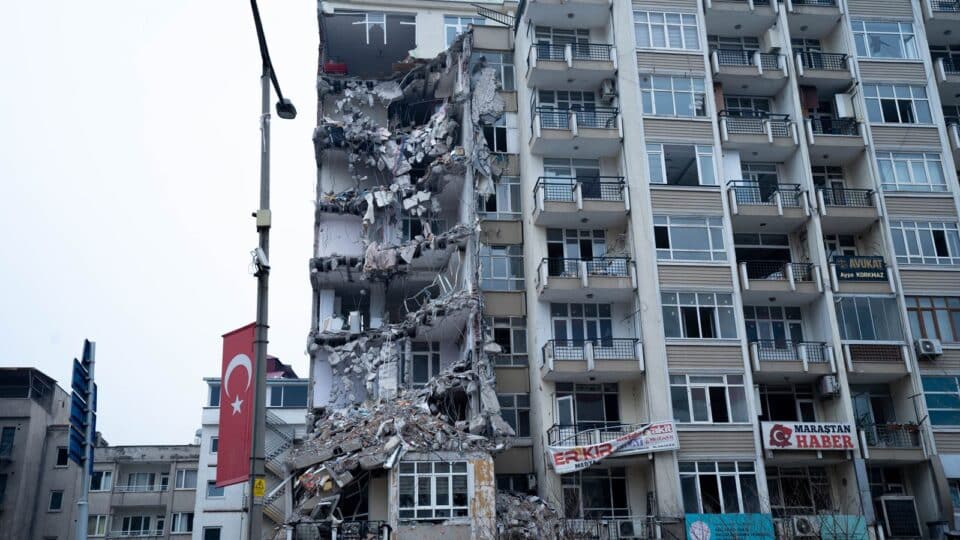
Featured-image note: the documentary photograph shows a building damaged after an earthquake in Turkey in March 2023. Author: Ömer Furkan Yakar / Pexels, used under the platform’s licence. It does not show an earthquake in Romania or an event in October 2026.
Sources and further reading
- INCDFP – About earthquakes: magnitude, hypocentre, epicentre and Romania’s seismicity.
- INCDFP – National Seismic Network, ROMPLUS and ShakeMap maps.
- USGS – What is the difference between earthquake magnitude and earthquake intensity?.
- USGS – Earthquake Magnitude, Energy Release, and Shaking Intensity; Northridge versus Nisqually.
- USGS – At what depth do earthquakes occur and what is the significance?.
- IRIS – Effect of depth on intensity, an educational example using two US earthquakes.
- INCDFP – Focal mechanism and directivity for intermediate-depth Vrancea earthquakes.
- INCDFP – Site effects and ShakeMap for Bucharest.
- USGS – What is Directivity?.
- Washington Geological Survey – Effects of local soil conditions on ground motion.
- USGS ShakeMap – Interpreting PGA, PGV, spectra and estimated intensities.
- USGS – Secondary effects of earthquakes, including liquefaction.
- USGS – The limits of earthquake prediction.
- IGSU/ISU Sălaj – Official safety recommendations during an earthquake.
- Fii Pregătit – National earthquake-preparedness guide.


Discuția cititorilor
Ai o opinie sau o întrebare despre acest articol? Spune-ne ce crezi.
Fii primul care deschide discuția.
Te rugăm să păstrezi un limbaj civilizat și să discuți la subiect. Comentariile spam sunt filtrate automat.