
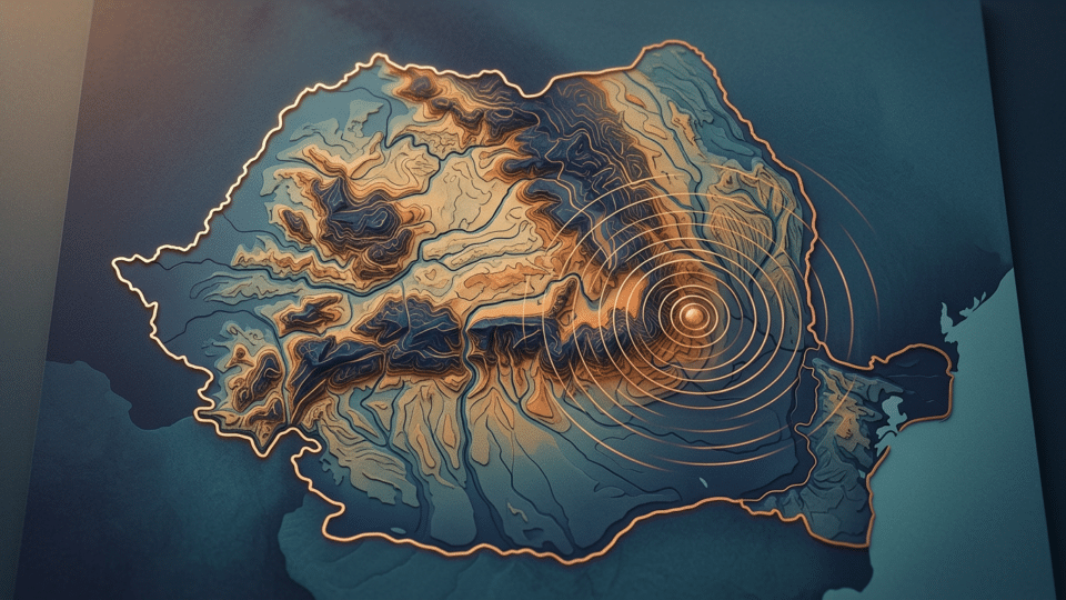
A magnitude 4.8 earthquake struck the Vrancea region on Monday, 19 October 2026, at a depth of 124.1 kilometres and was felt in Bucharest. Residents of some high-rise buildings in the capital noticed the oscillations caused by the quake. Beyond the initial alerts and reactions, specialists’ updated data offers a more precise picture of the event. What does a depth of 124.1 kilometres mean, how unusual is such an earthquake, and what can responsibly be said about future risks?
For more information on Romania’s General Inspectorate for Emergency Situations (IGSU), see also Hadja Lahbib’s visit to Bucharest: what Romania can request through the EU crisis mechanism and what remains IGSU’s responsibility, which provides complementary details on the subject.
The 19 October 2026 earthquake: what seismologists recorded
At 11:51:57 Romanian time on Monday, 19 October, a local-magnitude 4.8 earthquake occurred in the Vrancea seismic zone, in Buzău County.
According to the National Institute for Earth Physics Research and Development (INFP), the event was located at a depth of 124.1 kilometres and classified as an intermediate-depth earthquake.
INFP also reported intensity IV, corresponding to light ground shaking on the macroseismic intensity scale.
Official earthquake data:
- Date: 19 October 2026
- Time: 11:51:57, Romanian time
- Magnitude: 4.8 ML
- Depth: 124.1 kilometres
- Region: Vrancea–Buzău seismic zone
- Intensity reported by INFP: IV
- Coordinates: 45.4745° N and 26.3147° E
- Assessment status: manually revised
Its location in the Vrancea zone does not automatically mean that the epicentre lies administratively within Vrancea County. The seismic region extends across the Carpathian bend, including areas of Buzău County.
Under the revised location, the earthquake occurred about 54 kilometres south of Buzău, 59 kilometres east of Brașov, 60 kilometres south-east of Sfântu Gheorghe, 63 kilometres north of Ploiești and 72 kilometres south of Focșani.
These distances are geographical positions calculated from the epicentre, not the limits of where seismic waves could be felt.
Why the earthquake’s depth changed from 76.5 to 124.1 kilometres
An important detail that may confuse readers is the difference between the information released immediately after the earthquake and the later assessment.
The initial data generated by INFP’s automated systems gave a magnitude of 4.8 and a depth of 76.5 kilometres. Those figures were quickly reported by numerous news outlets.
After analysing and manually reviewing the records, INFP updated the depth to 124.1 kilometres and adjusted the location of the epicentre. The magnitude remained 4.8.
The difference is significant in seismological terms, but it is not evidence of a second earthquake.
These are two assessments of the same seismic event, not two separate earthquakes.
In the first seconds after an earthquake begins, automated systems use the available signals to rapidly estimate its location, magnitude and depth.
As additional information from seismic stations is analysed, those parameters may be corrected.
This is why revised specialist assessments are preferable to initial automated estimates when they are available.
For the public, the difference explains why two articles about the same earthquake can give different figures, without either publication having invented information.
Why the earthquake was felt in Bucharest
The shaking was felt in several parts of Romania, including the capital. There were also reports that it was felt in the Republic of Moldova.
That an earthquake originating in the Vrancea zone can be felt at considerable distances is not unusual.
The explanation lies in the geological characteristics of the region and in how seismic waves travel.
Unlike shallow earthquakes, which occur at relatively limited depths and can have very strong effects close to the epicentre, intermediate-depth Vrancea events originate tens or even more than 100 kilometres below the Earth’s surface.
The waves they generate can reach a broad geographical area.
Depth affects both the distance waves travel to the surface and the distribution of ground motion.
Local ground conditions also matter. Sedimentary layers can alter the amplitude and duration of oscillations, while buildings respond differently according to their height, structure, stiffness and natural vibration period.
In Bucharest, some tall buildings can make movement more noticeable to people on upper floors.
This does not mean every high-rise is automatically dangerous, or that visible swaying indicates damage.
A building’s behaviour must be assessed against its structural characteristics and the actual seismic loading.
Magnitude 4.8 and intensity IV: two figures that do not mean the same thing
In earthquake reporting, magnitude and intensity are often confused.
Magnitude describes the size of a seismic event at its source. It is calculated from instrumental records and expressed on a logarithmic scale.
Intensity describes the effects of ground motion in a particular place, including how people perceive it and its observable effects on objects and buildings.
An earthquake has one determined magnitude, but it may produce different intensities in different localities.
For the 19 October 2026 earthquake, INFP reported a local magnitude of 4.8 and intensity IV.
At this intensity level, shaking may be felt by several people indoors, and suspended or light objects may sway.
This classification should not be interpreted as a guarantee that no building can be affected. Buildings vary in vulnerability, and any damage must be confirmed through observation and inspection.
There is another important distinction: the popular phrase “degrees on the Richter scale” is often used for all earthquakes, but seismologists use several types of magnitude, including ML and Mw. For this event, INFP’s revised assessment gave ML 4.8.
Were there damage or casualties? What authorities said
After the earthquake, authorities began checks to identify any possible consequences.
The Bucharest–Ilfov Emergency Situations Inspectorate sent a response vehicle to the capital’s Old Town area for reconnaissance work.
Raed Arafat, head of the Department for Emergency Situations (DSU), said teams from emergency situations inspectorates had also been mobilised for checks in other regions.
According to information made public during the first part of the day, no 112 emergency calls concerning negative effects from the earthquake had been recorded.
In updates issued up to around 1:30pm, no casualties or confirmed material damage had been reported.
This information reflects what was known when the initial statements were issued, rather than a final tally for the whole day.
It is important to distinguish between feeling an earthquake, experiencing vibrations in a building and the existence of actual structural damage.
Clearly felt ground motion does not automatically cause damage. At the same time, the absence of an emergency call cannot replace an inspection of a building where visible signs of damage have appeared.
Why Vrancea is one of Europe’s most important seismic regions
Understanding the 19 October earthquake requires looking at the geological structure of the region where it occurred.
The Vrancea zone lies at the bend of the Eastern Carpathians, in a complex geological sector where several tectonic units interact.
According to INFP research, intermediate-depth seismic activity is concentrated at depths of roughly 60 to 200 kilometres.
A distinctive feature of the region is a relatively narrow, near-vertically oriented lithospheric volume in which numerous intermediate-depth earthquakes occur.
Deformation processes and the accumulation of stress in this volume explain part of the seismic activity specific to the area.
Vrancea differs from many other European seismic regions, where most earthquakes are shallow and associated with fault systems in the Earth’s crust.
In Romania, strong Vrancea earthquakes are particularly significant because their waves can spread towards densely populated areas in Muntenia and Moldova.
Bucharest is one of the urban agglomerations for which this characteristic must always be considered in seismic-hazard assessments.
Risk to the population, however, depends not only on the earthquake itself but also on the vulnerability of buildings, population density, compliance with building standards and emergency response capacity.
Seismic hazard is a characteristic of a region. Seismic risk arises when that hazard meets vulnerable people, buildings and infrastructure.
The distinction is essential to a responsible public debate.
What the history of major Vrancea earthquakes tells us
Romania has a documented seismic history, and the major events of the past century demonstrate the potential of the Vrancea region.
The most significant include the November 1940 earthquake, with an estimated moment magnitude of 7.7; the 4 March 1977 earthquake, of approximately magnitude 7.4; the August 1986 earthquake, of approximately magnitude 7.1; and the May 1990 event, of approximately magnitude 6.9.
These earthquakes contributed to the development of seismological research and improvements in earthquake-resistant design standards.
Historical comparisons must nevertheless be made properly.
The 19 October 2026 earthquake, at magnitude 4.8, was much smaller than the major Vrancea earthquakes.
It should not be presented as a repeat of the catastrophic events of the past, nor as evidence that such a disaster is imminent.
At the same time, Romania’s seismic history remains a strong argument for strengthening vulnerable buildings and preparing the population.
History does not offer an exact timetable for future earthquakes. It provides important information for probabilistic hazard assessment.
Does a magnitude 4.8 Vrancea earthquake signal a stronger one to come?
This is one of the most frequent questions after any widely felt earthquake.
The scientific answer requires caution.
There is currently no validated method that can predict the exact date, time, location and magnitude of a future major earthquake.
Specialists can analyse seismic activity, tectonic mechanisms and long-term probabilities, but these do not amount to an exact prediction.
A magnitude 4.8 earthquake does not, by itself, allow the conclusion that a stronger event will follow.
Equally, it does not demonstrate that the region has released enough energy to rule out a future major earthquake.
Claims that every moderate earthquake “announces the big one” are not supported by scientific evidence.
The idea that a moderate earthquake removes the risk of a powerful event is also wrong.
In reality, seismic behaviour is complex, and research seeks to understand mechanisms and probabilities rather than offer impossible certainties.
Could aftershocks occur after the 19 October earthquake?
In principle, subsequent seismic events can occur in the same region.
Some earthquakes are followed by aftershocks, which are adjustments in the stress system around the seismic source.
Not every moderate earthquake, however, is followed by a sequence of aftershocks felt by the public.
Seismologist Mihai Diaconescu said in televised remarks on 19 October that the magnitude 4.8 event falls within the usual behaviour of the Vrancea region, and that lower-magnitude aftershocks may occur.
This observation should not be turned into a firm prediction of the number or timing of future earthquakes.
Subsequent seismic activity should be followed through data published by INFP and other competent seismological centres.
What to do if an earthquake begins
The 19 October event brings a far more useful question into focus than trying to guess when the next earthquake will happen: how well prepared are we?
Emergency situations inspectorates recommend simple but essential measures.
If you are inside a building:
- Stay calm and avoid unnecessary movement.
- Take shelter under a sturdy table or desk if one is nearby.
- Protect your head and neck.
- Move away from windows, mirrors, bookcases and furniture that could topple.
- Do not run to the stairs while the ground is shaking.
- Do not use a lift or try to go out onto a balcony.
If you are outdoors, move towards an open space, away from buildings, trees, poles and power lines, without exposing yourself to additional hazards.
After the earthquake stops, check whether people nearby need help and follow the authorities’ instructions.
If you see major cracks, structural deformations or other suspicious damage, do not assume the building is safe without a competent assessment.
If a gas leak is suspected, avoid open flames and operating electrical switches.
Every household is advised to know the safer places in its home and keep basic supplies, water, a torch, necessary medicines and a communication plan ready.
The 112 emergency number should be used for genuine emergencies, not to ask for the magnitude or confirm an earthquake that has already been announced.
Why a phone may send an earthquake alert but RO-ALERT does not warn before an earthquake
The earthquake revived discussion about the difference between seismic-notification systems available on phones and Romania’s national RO-ALERT platform.
Some Android phones can receive notifications generated by rapid detection and warning systems.
These systems attempt to identify an earthquake that is already under way and, in certain conditions, notify users before stronger waves reach their area.
This is not an earthquake prediction, but a form of early warning after the event has begun.
The time available to react depends on location, the speed of detection and wave propagation.
In Romania, authorities have said that RO-ALERT does not send notifications before earthquakes begin. The system may be used afterwards when an earthquake’s effects require protective measures to be communicated.
Therefore, the absence of a RO-ALERT message before the shaking does not in itself indicate a malfunction.
Today’s earthquake and the real vulnerability of buildings
An earthquake of moderate magnitude can be a useful moment to reassess the safety of homes.
Especially in cities with older building stock, such as Bucharest, the central issue is not only the frequency of earthquakes but also buildings’ ability to withstand strong shaking.
The fact that a building has stood for decades does not automatically prove it is safe.
Similarly, feeling a building sway is not by itself evidence of a structural problem.
Assessing a building’s risk requires information about its design, materials, later alterations and state of maintenance and, where necessary, a technical assessment by authorised specialists.
Preparedness should also include seemingly minor measures: securing tall furniture, avoiding the storage of heavy objects above sleeping areas and identifying safe evacuation routes once the shaking has stopped.
These measures do not remove the hazard, but they can reduce the consequences for people.
What the 19 October earthquake ultimately means for Romania
The earthquake in the Vrancea–Buzău area once again confirms that Romania is in a region of ongoing seismic activity.
The magnitude 4.8 event was strong enough to be felt in several localities, but the available data do not justify alarmist interpretations about an imminent major earthquake.
INFP’s revised assessment, which places the hypocentre at a depth of 124.1 kilometres, helps explain its nature as an intermediate-depth earthquake.
How information is communicated to the public is equally important.
Preliminary estimates must be updated, effects on buildings must be checked, and statements about future earthquakes must be separated from speculation.
Vrancea does not need alarmist scenarios to be taken seriously. Its seismic history, scientific research and the vulnerability of some buildings already provide sufficient reasons for prevention.
The relevant message after 19 October 2026 is not that Romania should live in fear, but that safety is built before a strong earthquake: through information, more resilient buildings and appropriate conduct in emergencies.
Frequently asked questions about the Vrancea earthquake
What magnitude was the 19 October 2026 earthquake?
According to INFP’s revised assessment, the earthquake had a local magnitude of 4.8 ML.
What time did it occur?
The earthquake was recorded at 11:51:57 Romanian time on Monday, 19 October 2026.
What was the actual depth?
INFP revised the depth from the initial automated estimate of 76.5 kilometres to 124.1 kilometres.
Was the earthquake felt in Bucharest?
Yes. The shaking was felt in the capital, including in some high-rise buildings.
Were casualties or damage reported?
According to authorities’ updates during the first part of 19 October, no casualties or confirmed material damage had been reported. Emergency inspectorate teams were carrying out checks.
Can the next Vrancea earthquake be predicted?
There is currently no validated scientific method that can predict the exact date, time, location and magnitude of the next major earthquake.
Sources and reporting
- INFP – official revised assessment of the 19 October 2026 earthquake
- INFP – seismicity and earthquake information
- Digi24 – DSU response and checks by authorities
- Știrile ProTV – Emergency Situations Inspectorate updates and RO-ALERT messages
- Antena 3 CNN – seismologist Mihai Diaconescu’s explanation of aftershocks
- USGS – why earthquakes cannot be predicted exactly
Read also: Magnitude 3.3 earthquake in the Vrancea zone, Buzău County: why depth matters more than proximity to cities and Earthquake in Buzău on 11 August 2026: magnitude 4.3 event in Vrancea.









Discuția cititorilor
Ai o opinie sau o întrebare despre acest articol? Spune-ne ce crezi.
Fii primul care deschide discuția.
Te rugăm să păstrezi un limbaj civilizat și să discuți la subiect. Comentariile spam sunt filtrate automat.