
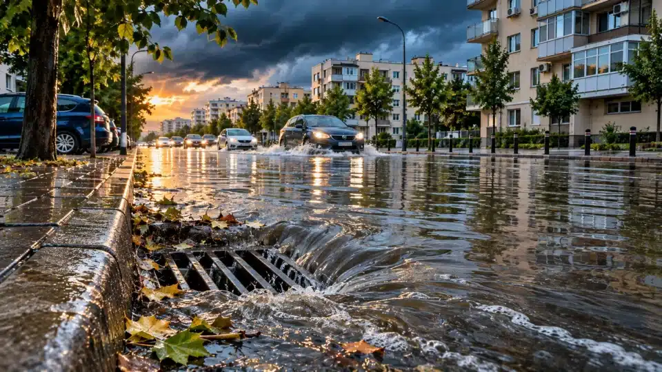
Storm drainage and urban flooding explain why a street can end up underwater in just 20 minutes, even where there is no visible burst pipe. An intense downpour can send huge volumes of water simultaneously from roofs, car parks and boulevards towards the same drains. If the inlets, collectors or final discharge point are overwhelmed, water remains on the surface. Leaves and rubbish can worsen the problem, but they are not automatically its only cause.
In Constanța, there is a recent official reference point: on 27 October 2026, RAJA reported 52 reports and 28 response teams deployed across the county. Most calls came from Constanța city, including Coiciu, Palazu Mare, Tomis Nord and the Delfinariu–Chiliei area. This was the tally of reports at the time of the announcement, not the number of faulty pipes. RAJA’s official statement, published by City Hall.
Storm drainage and urban flooding: the 20-minute calculation
Rainfall of 20 mm is equivalent to 20 litres per square metre. One hectare covers 10,000 m², producing 200,000 litres, or 200 m³. If that entire amount falls within 20 minutes, the theoretical average is about 167 litres per second per hectare. These figures are the arithmetic result of the rainfall amount, not an actual flow rate measured in a Constanța pipe.
For a hypothetical neighbourhood with many impermeable surfaces, let us use an illustrative runoff coefficient of 0.8. About 160 m³ per hectare would enter the drainage system, with an equivalent average flow of 133 l/s/ha. The actual peak may differ, depending on how the rainfall is distributed, gradients and the time it takes for water to reach the drainage network.
| Hypothetical rainfall in 20 minutes | Water per hectare | Estimated runoff at a 0.8 coefficient |
|---|---|---|
| 10 mm | 100 m³ | 80 m³ |
| 20 mm | 200 m³ | 160 m³ |
| 40 mm | 400 m³ | 320 m³ |
| 60 mm | 600 m³ | 480 m³ |
These examples are not the meteorological values recorded on 27 October 2026 and do not indicate the design capacity of an actual network. A technical diagnosis requires short-interval rainfall data, the drainage catchment area and the hydraulic parameters of the system.
Why rainwater no longer soaks into the ground
In natural areas, some water infiltrates the ground or is held temporarily. On asphalt, concrete, roofs and impermeable paving, runoff forms quickly. When car parks and new buildings are added to the same catchment, peak flow can increase even if the pipe network has not changed. A street upgrade undertaken without analysing the whole drainage catchment can shift pooling from one point to another.
A sewer system may be combined, with certain wastewater and rainwater flows carried together; separate, with a dedicated network for rainwater; or it may contain areas with different configurations. It is therefore not correct to say that every drain in Constanța leads to an identical collector. The network type must be confirmed with the operator and the technical plans.
Eight reasons cities flood after torrential rain
1. Rainfall exceeds the design standard
Pipes are sized using technical criteria and rainfall probabilities. A storm that exceeds the service standard can cause pooling even in a maintained network. This explanation must be demonstrated with data, rather than automatically invoked after every incident.
2. Drains are blocked
Leaves, soil and debris can block grates or connections. Water cannot enter the network quickly enough. Preventive cleaning can help, but it does not increase the diameter of a collector that is already overloaded.
3. Pipes no longer match the development of the neighbourhood
The expansion of built-up areas increases runoff. Addressing it requires an investigation of the entire contributing area and, where necessary, a redesign of the routes — not the arbitrary replacement of a single pipe.
4. The street gradient encourages pooling
Depressions, kerbs and settlement direct water. Resurfacing and changes to road geometry can create low points even if the nearby drain is working properly.
5. The final discharge is constrained
If the receiving water body is at a high level or the collector at the end of the network is carrying a heavy load, water may be discharged more slowly. In a coastal city, local conditions must be checked, but not every flood is caused by sea level.
6. Pumping stations cannot handle the flow
Where pumping stations exist, electricity supply, capacity and redundancy affect drainage. The presence of a pump — or a pump failure — should not be assumed without a technical report for the installation concerned.
7. Connections or collectors are damaged
Cracks, sediment build-up and unsuitable connections can reduce capacity. A CCTV pipe inspection and maintenance records can clarify the situation.
8. Water-retention spaces are lacking
Retention basins, rain gardens and green areas designed to manage water can delay runoff into the network. They do not replace every collector, but can reduce peak flows if properly located and maintained.
Constanța has explicitly included sewer resizing in its plan
In the Constanța Municipality Sustainable Energy and Climate Action Plan, measure A02 provides for the “resizing of the sewerage system so that it can accommodate surplus water from intense rainfall within the built-up area”. The stated timeframe is 2024–2030, and the intended outcome is the area served by the modernised system. Official SECAP plan, adaptation-actions table.
The inclusion of this measure in the document does not demonstrate that all works had been completed, funded or formally accepted by November 2026. Progress can be checked only by examining projects by section, funding sources, contracts, works progress reports and acceptance records.
What RAJA’s 27 October 2026 tally tells us
The operator activated its Emergency Situations Command and deployed 12 teams in the city and 16 across the rest of the county, equipped with motor pumps, vacuum trucks and other machinery. RAJA said persistent rain was complicating operations: water that had been pumped out was continually replaced by new volumes. The 27 October 2026 announcement.
This situation shows a need for operational intervention, but it does not establish the technical causes on every street. The 52 reports are not a full hydraulic inspection report and cannot be interpreted as 52 instances of negligence.
Who is responsible: City Hall, RAJA, the road authority or the property owner?
Law No. 241/2006 states that sewerage services are organised under the coordination and responsibility of local public authorities; its definition includes the discharge of rainwater and ensuring that drains function properly. In practice, responsibility for a collector, a road, a courtyard or an internal installation may lie with different entities.
| Situation | Who should be checked | Documents needed |
|---|---|---|
| Drain on a public road | The operator and infrastructure administrator | Network inventory, service delegation contract, cleaning log |
| Undersized collector | The authority responsible for investment and the operator | Hydraulic design, sizing data |
| Backflow into a basement | The administrator of the shared installation and the operator, depending on the boundary of responsibility | Installation plans, findings and damage history |
| Water coming from a courtyard | The owner and, where applicable, the administrator of the private system | Drainage plan and technical assessment |
| Exceptional rainfall | The authorities and operator in relation to the applicable obligations | Meteorological data, incident report and design documentation |
It cannot be said that City Hall or the operator automatically owes compensation for every torrential downpour. Civil liability depends on the specific obligations, the damage, the causal link and the circumstances. At the same time, merely citing intense rainfall does not prove that maintenance or design was adequate.
My home or car has flooded: what should I document?
- Safely photograph and record the location, date, time and progression of the water.
- Report the issue to the relevant administrator and retain the registration number.
- Request any intervention and assessment reports.
- Keep documents for the affected property, estimates, receipts and insurance contracts.
- Do not enter flooded basements where electrical equipment is live, and do not attempt to rescue possessions if doing so puts you at risk.
- For compensation, separately check the terms of the policy and the possibility of a complaint or legal action, according to the circumstances.
How a repeatedly flooded intersection is professionally assessed
- ANM data showing short-interval rainfall intensity and the exact time of the event.
- The drainage catchment area, extent of impermeable surfaces and road geometry.
- A map of drains, collectors, pipe diameters and pumping stations.
- The dates of the latest cleaning, inspections and interventions in the system.
- Hydraulic modelling and comparison with the design parameters.
- Recent urban-development changes and approved modernisation projects.
- Confirmation that the proposed solution reduces risk rather than merely shifting water to the next street.
Long-term solutions: pipes, retention, greenery and planning
A more resilient city needs a combination of measures. Preventive cleaning removes obstructions; upgrading collectors increases capacity where studies justify it; retention basins temporarily reduce flows; permeable paving and rain gardens can manage some runoff. Every solution has limits: soil conditions, costs, land availability and maintenance are decisive.
A sound drainage policy also accounts for new property developments. In an already crowded area, a larger collector may not solve everything if the surface sending water into it continues to grow. Sometimes the most consequential investments are upstream, in retention spaces and in water management on new developments.
What the new EU directive requires — and what it does not yet require
Directive (EU) 2024/3019 introduces integrated plans for managing urban wastewater and the pressures rainfall places on collection systems. For drainage areas serving agglomerations of at least 100,000 population equivalent, the deadline for drawing up these plans is 31 December 2033. EUR-Lex, Article 5.
The deadline does not mean that every street must already have been rebuilt by 2026. The directive is relevant to integrating runoff management and reducing pollution; it is not a promise that any city can completely eliminate flooding caused by extreme events.
What to do when water rises quickly
- Do not cross flooded streets by car or on foot if the depth and current are unknown.
- Do not touch electrical equipment in flooded areas or enter basements with electrical installations that may be live.
- Follow warnings from ANM, RO-Alert and the General Inspectorate for Emergency Situations (ISU); in immediate danger, call 112.
- Do not lift manhole covers or drain grates yourself during a storm.
- Only clear drains on your own property preventively, in safe conditions and without interfering with public infrastructure.
- For sewerage problems in the RAJA service area, check the operator’s current contact details and report the situation.
These safety recommendations are supported by IGSU guidance on dangerous hydrometeorological phenomena.
Seven questions for City Hall and the operator
- Who manages the collector and drains on the affected street?
- When were they last cleaned and inspected?
- For what rainfall intensity and probability was the network designed?
- What rainfall amounts and intensities were measured during the incident?
- Are there documented faults, sediment build-up or unavailable pumping stations?
- Which projects under Constanța SECAP measure A02 are funded and under construction?
- What indicators will demonstrate an actual reduction in risk after the investment?
Frequently asked questions about storm drainage
Can only 20 minutes of rain flood a neighbourhood?
Yes. Intensity matters more than duration considered in isolation. A downpour of 20 mm in 20 minutes delivers 200 m³ per hectare, before infiltration and retention.
If the grates are clean, does that necessarily mean the drainage system works?
No. The collector, gradients, pumping stations and discharge point can all constrain capacity. Cleaning a grate is necessary, but not sufficient.
Why does the same street flood after every storm?
It may have a low point, insufficient capacity, a recurring blockage or a combination of factors. Without hydraulic data, a single cause cannot be identified.
Are all stormwater networks separate from wastewater sewers?
No. The configuration may be combined, separate or mixed, depending on the area’s actual infrastructure.
Who pays for a flooded car?
There is no automatic compensation. Insurance terms, the parties’ obligations and the link between any breach and the damage must be assessed individually.
Does Constanța have an official measure for this problem?
Yes. The SECAP includes measure A02 to resize the system, with a 2024–2030 timeframe. The status of each project must be checked separately.
Conclusion: a city cannot be protected by vacuum trucks alone
Urban flooding generally has no single cause. Rainfall intensity, paved surfaces, street geometry, collector capacity and maintenance all act together. In Constanța, there is both a plan that recognises the risk and a recent incident that prompted an official response. The real test for the authorities is whether investments are completed, documented and reduce risk in the next rains — not simply how much equipment is sent once water is already in the street.
Official sources and methodology
- Constanța City Hall — Sustainable Energy and Climate Action Plan: measure A02, 2024–2030 period.
- RAJA / Constanța City Hall — 27 October 2026 statement: tally of 52 reports and 28 teams.
- Law No. 241/2006 — Legislative Portal: sewerage services and rainwater.
- Directive (EU) 2024/3019 — EUR-Lex: integrated plans and their timetable.
- IGSU — safety recommendations for hydrometeorological phenomena: self-protection.
- InfoBuz — flood warnings in Constanța: internal contextual article.
Editorial note: researched on 17 November 2026. The calculation based on 20 mm in 20 minutes and the 0.8 coefficient are hypothetical examples, not actual measurements from Constanța. The article image was AI-generated and does not depict an identified street. RAJA’s data refer strictly to the time of its 27 October statement.







Discuția cititorilor
Ai o opinie sau o întrebare despre acest articol? Spune-ne ce crezi.
Fii primul care deschide discuția.
Te rugăm să păstrezi un limbaj civilizat și să discuți la subiect. Comentariile spam sunt filtrate automat.